
Westhampton Area
Richmond Virginia
The first picture is looking eastbound towards the city on Patterson. The traffic light is at the intersection of Three Chopt Road. On the right is the deep ravine behind the Village Shopping Center, which hadn't been built yet. The city had annexed this part of Henrico in 1942, and the city limits sign can be seen in the same place as today's modern green sign. The state route signs are still partly accurate. Patterson is still Route 6, but Three Chopt lost its Route 197 designation in 1966. To be clear, all of Three Chopt wasn't Route 197...only the portion from Patterson to Cary...and only from July 1933 to July 1966. After that Route 197 was reassigned to its current routing...roads connecting Windsor Farms to Chamberlayne Ave (Malvern, Westwood, Saunders, Laburnum).
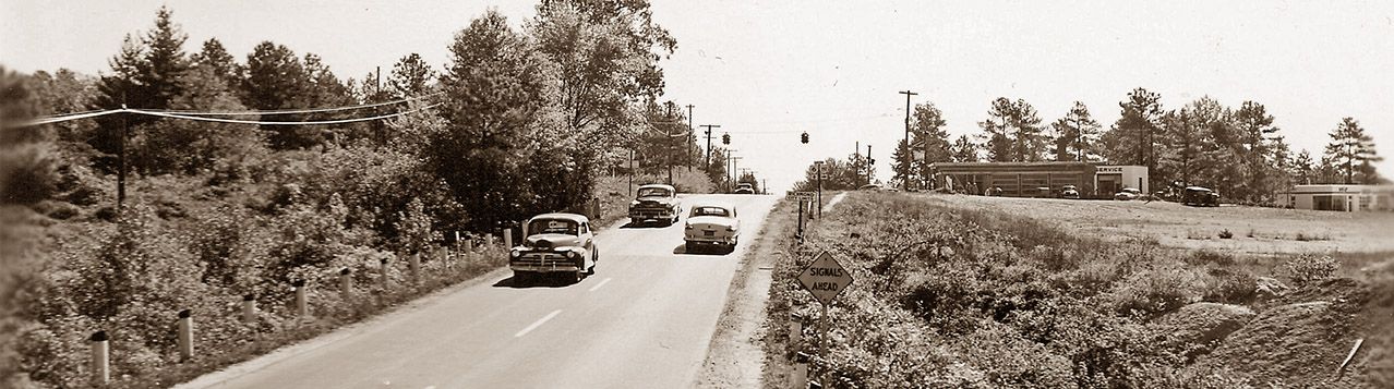
The building at the intersection is a Crown Gas station which predated the Toddle House, before it became Dobbs House, which became Steak 'n Egg Kitchen, before being home to many other businesses like Billy Pie in that same location. To the right of the Crown station is another gas station which today is home to a foreign car repair shop. I believe that was a Gulf station, but I'm not sure. I do know that the station at the corner of Three Chopt & Kensington was a Phillips 66 in the 1950s, but that's not visible in this shot.
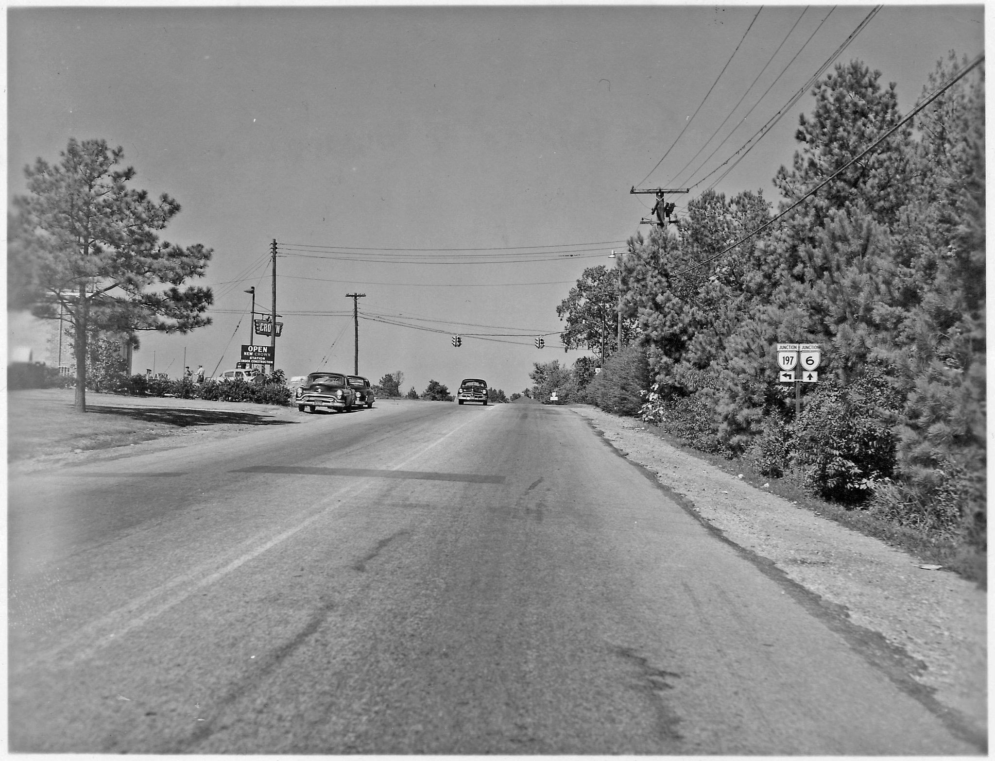
The next picture is from westbound Patterson Avenue approaching Three Chopt Road. Just past the intersection in the photo below, there's a road sign. The resolution isn't good enough to read it, but it's the Route 6 emblem on top, and beneath it are the distances to the towns Columbia and Scottsville.
Back then Patterson was only two lanes west of Commonwealth Avenue. It was always frustrating to be stuck behind a bus stopping at all the stops, and there wasn't enough room to pass. Patterson remained two lanes in the area around Three Chopt until 1961.
World War II Bomber Tower...The two images above help to narrow down the exact location of the structure staffed by volunteers to watch the sky for enemy planes (actually any planes). Since this was the highest elevation in the city, it was a good spot for it. I've often wondered where the structure stood. At least we know it wasn't on the northern side of Patterson, as that area was still wooded on both sides of Three Chopt after the war. University of Richmond professor Dr. Charles Wheeler mentioned his time there spotting planes in this 1988 interview. (Scroll to 00:17:17)
The ad below ran in the 11 December 1953 issue of The Collegian...University of Richmond newspaper.
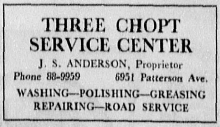
So, J.S. Anderson's Three Chopt Service Center had the Crown Gas dealership for the southeast corner of Three Chopt & Patterson. Also note the six digit phone number. When I moved into the neighborhood in 1953, we also had a similar six diget number, beginning with 8. A few years later everyone in the Westhampton area kept their existing number, but added a 2 in front of it when we went to seven diget numbers. Even today many Westhampton phone numbers begin with 28X-XXXX. To make these longer numbers easier to remember, the first 2 digits were converted to letters. So Mr. Anderson's new number was probably AT8-9959...or Atlantic 8-9959. In my class at Westhampton Elementary School, nearly everyone had Atlantic phone numbers. Other Richmond neighborhoods had their own prefixes...like MI for Milton; BE for Belmont; or EL for Elgin. You could usually tell someone's neighborhood by their phone number.
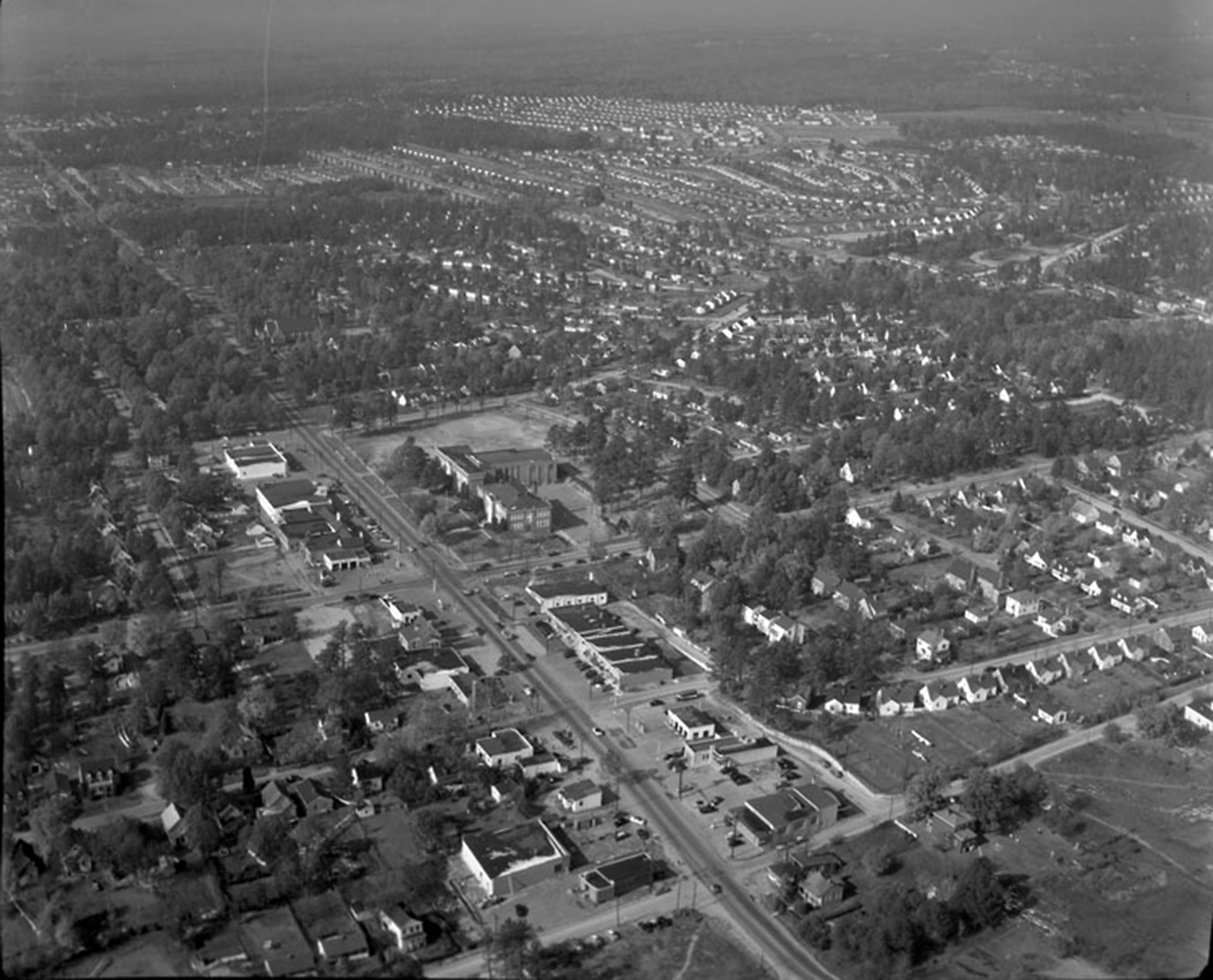
Below is a 1953 aerial shot of the area. The earlier Westhampton Post Office is visible in the lower part of the picture, on the northwest corner of Patterson and Glenburnie Road. The current shops adjacent to that building get their name, Post Office Square, not from the nearby modern post office, but from that building's history.
In the distance, Crestview Apartments can be seen. They were one of three low cost housing complexes that sprung up just over the line in Henrico County after the war. The others being Suburban Apartments (Staples Mill) and Keswick Gardens (Willow Lawn Dr.) All three have been razed and replaced with structures more appropriate to the area.
Some of those pine trees on the eastern side of Maple Ave, bordering the athletic field, are still there today. Also note that there were no curbs on Patterson, which allowed cars to park right in front of the shops on the 5700 block. Also, both Libbie and Patterson were still just two lanes each. This was soon to change.
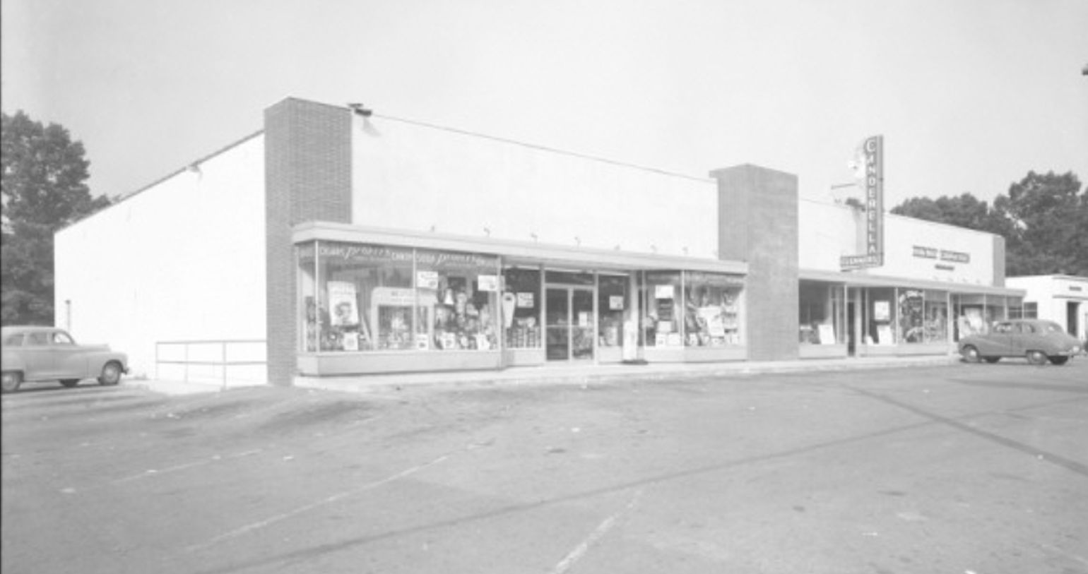
The photo below shows People's Drug Store, the laundromat, and Dixie Kitchen 21 June 1955 directly across Patterson from the school's athletic field. Now Westwood Pharmacy is in that location.
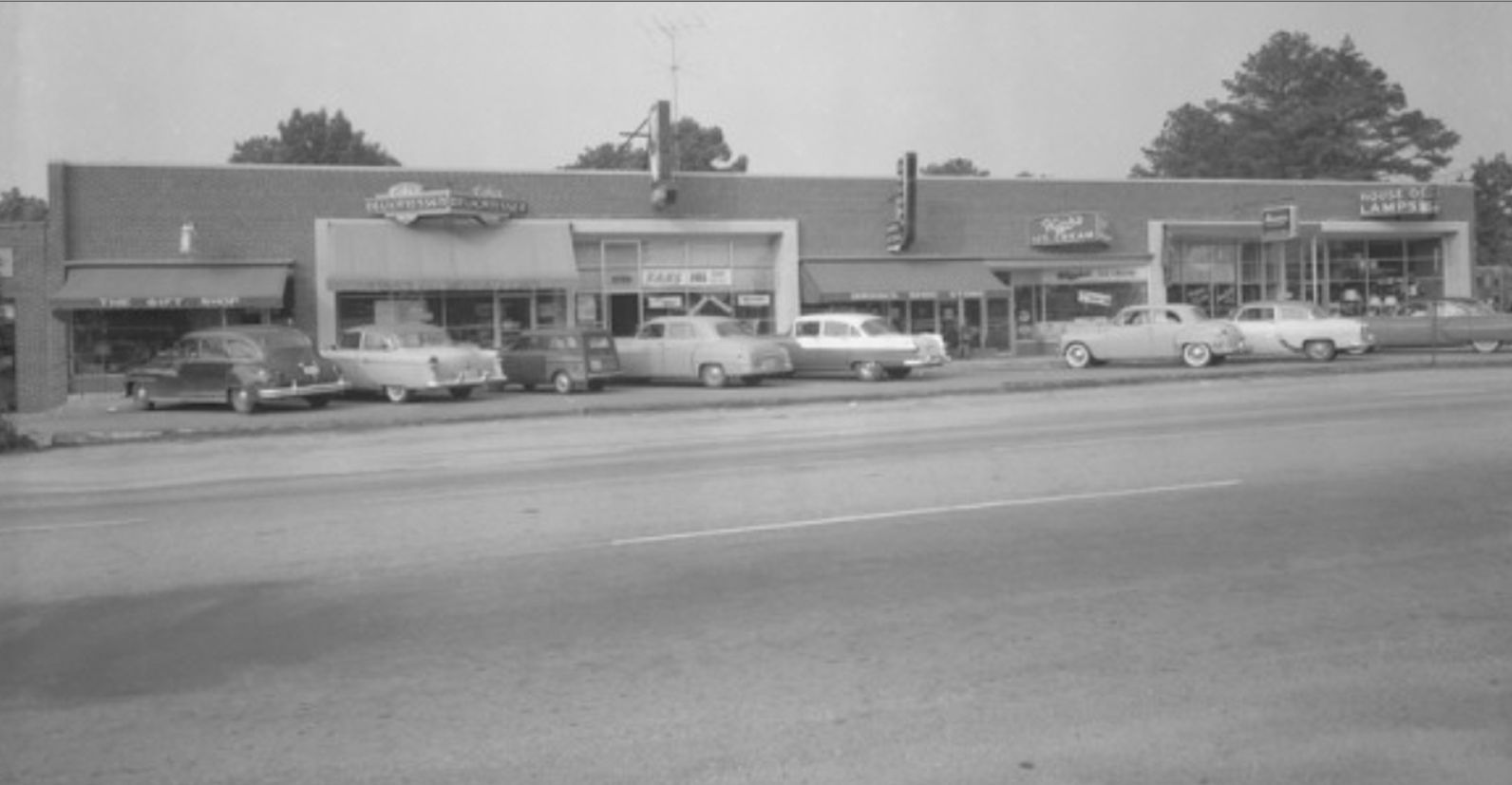
Also shot on 21 June 1955 is the photo below of the north side of the 5700 block of Patterson. Several of these businesses were still there many years later. I believe that was the first location for Saxon Shoes, and a visit to High's Ice Cream was always something to look forward to.
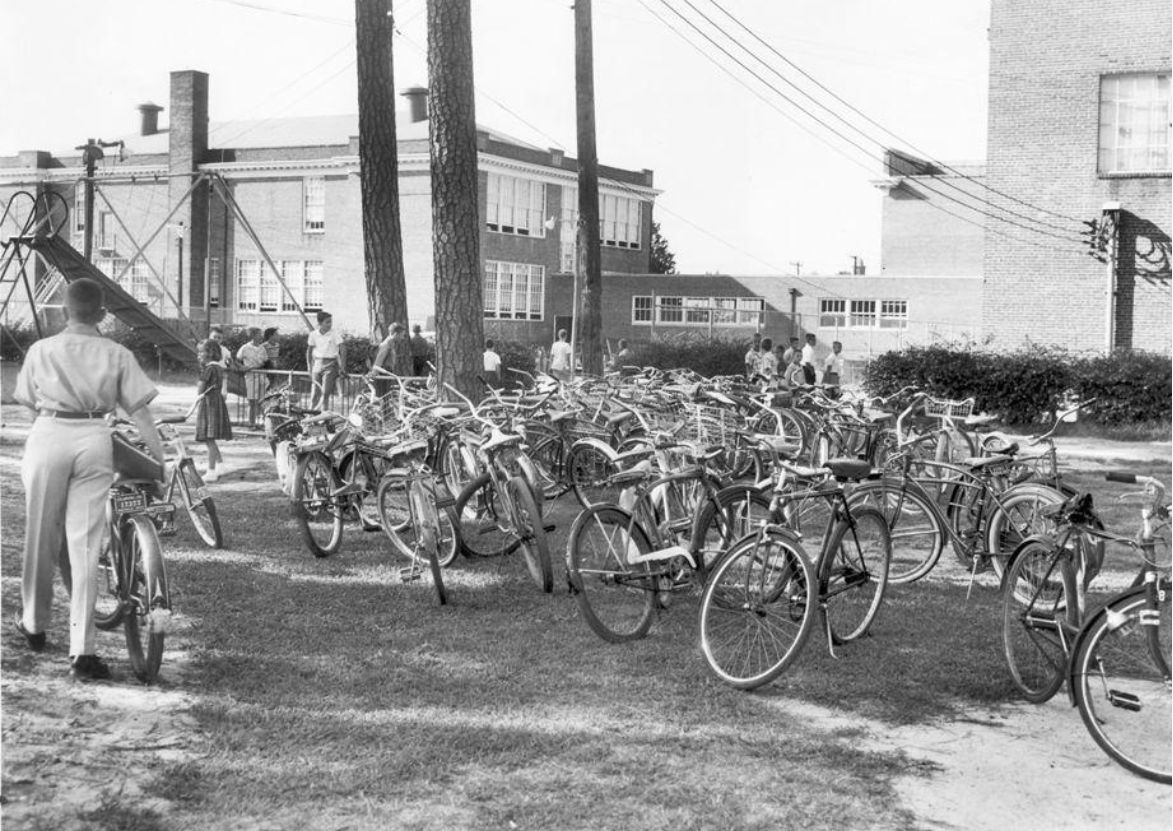
September 1958...I was in Mrs. Evans' class in Room 11 at Westhampton Elementary School when the photo below was taken. This was the second year in a row our class had the same teacher. But I think we were too much for her, because after two years with us she retired! I would sometimes ride my bike to school...in good weather.
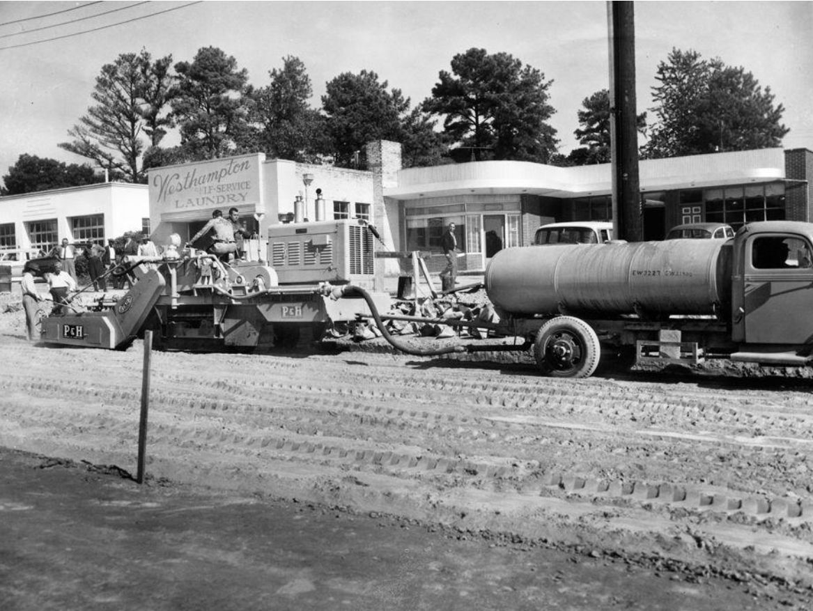
The widening of Patterson Ave. which started at Commonwealth Ave. had worked its way westward, and had made it to the area around Westhampton School. The photo below was taken in October 1958. Looking east from Patterson and Libbie, the post office is in the distance, and Westhampton Pastry Shop can be seen...in the same location as now. Update!
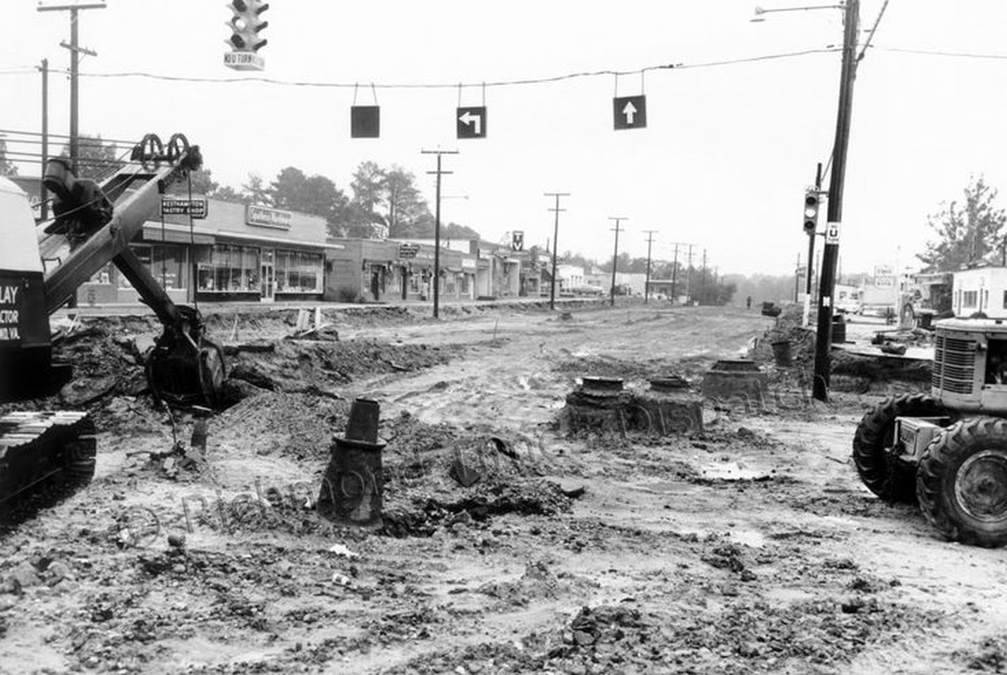
Looking at what is now Post Office Square, the photo below was also taken in October 1958. Frank Hyde's barbershop was one of the businesses in this cluster. The 5600 and 5700 blocks of Patterson had been closed since early August. This was a BIG project.
Over on Grove, the road had already been widened when the streetcar tracks were removed from the middle of the road. But you can bet they were seeing more traffic as people had to detour around the work on Patterson. But in the photo below, taken 9 April 1959 at the intersection of Granite Ave, it doesn't look too busy. A traffic light was eventually installed there in 2024.
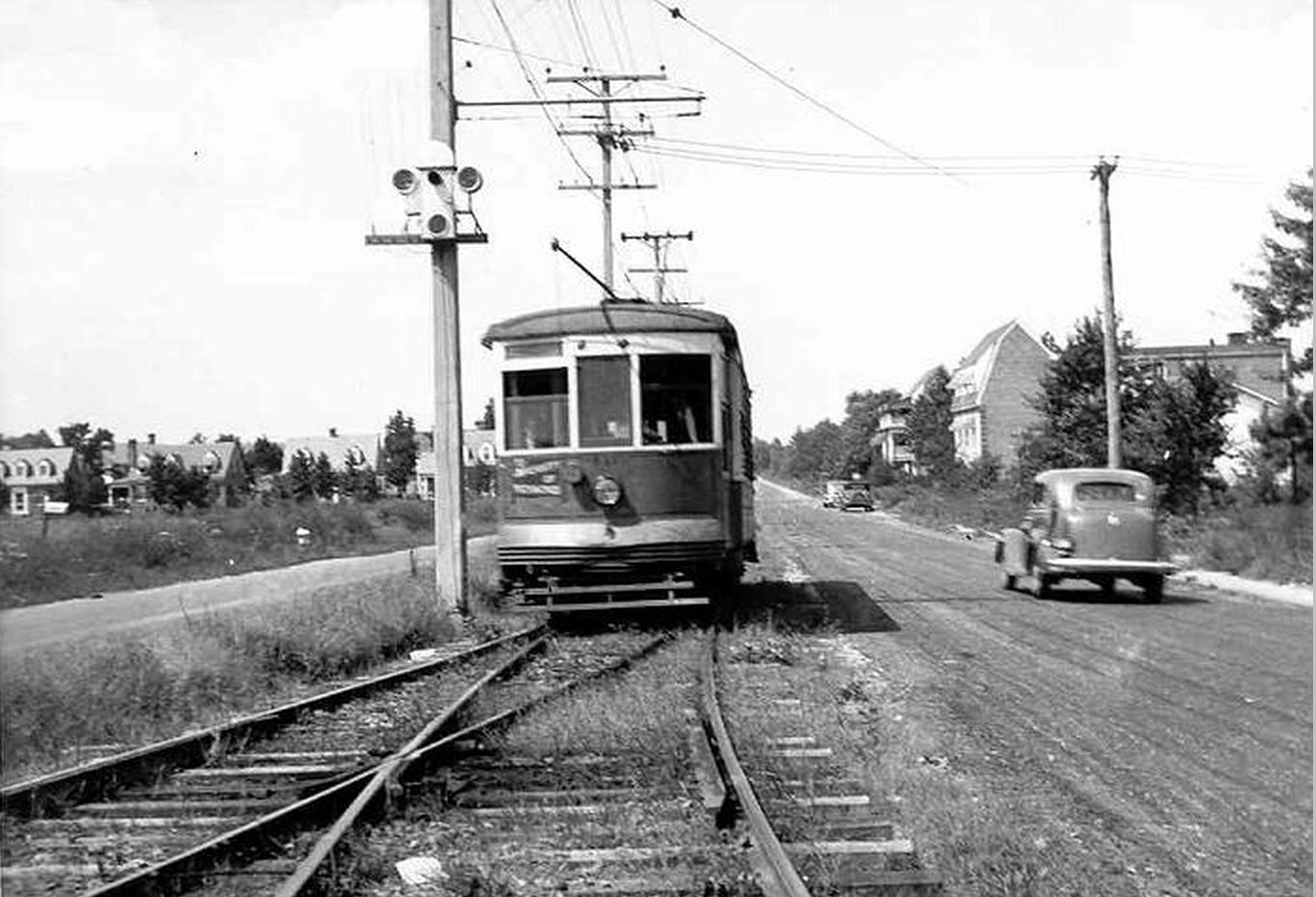
The photo below, from the 1940s, also shows Grove Ave near where Mary Munford School would be built. The #9 streetcar on the Westhampton Park Line can be seen here. Although the University of Richmond had long replaced the amusement park by then. My paternal grandfather drove streetcars on this line. Some of those concrete utility poles remained in the median strip for decades after this photo was taken.
Below is a more recent view of the area around Grove and Westmoreland. Much has changed, but not everything.
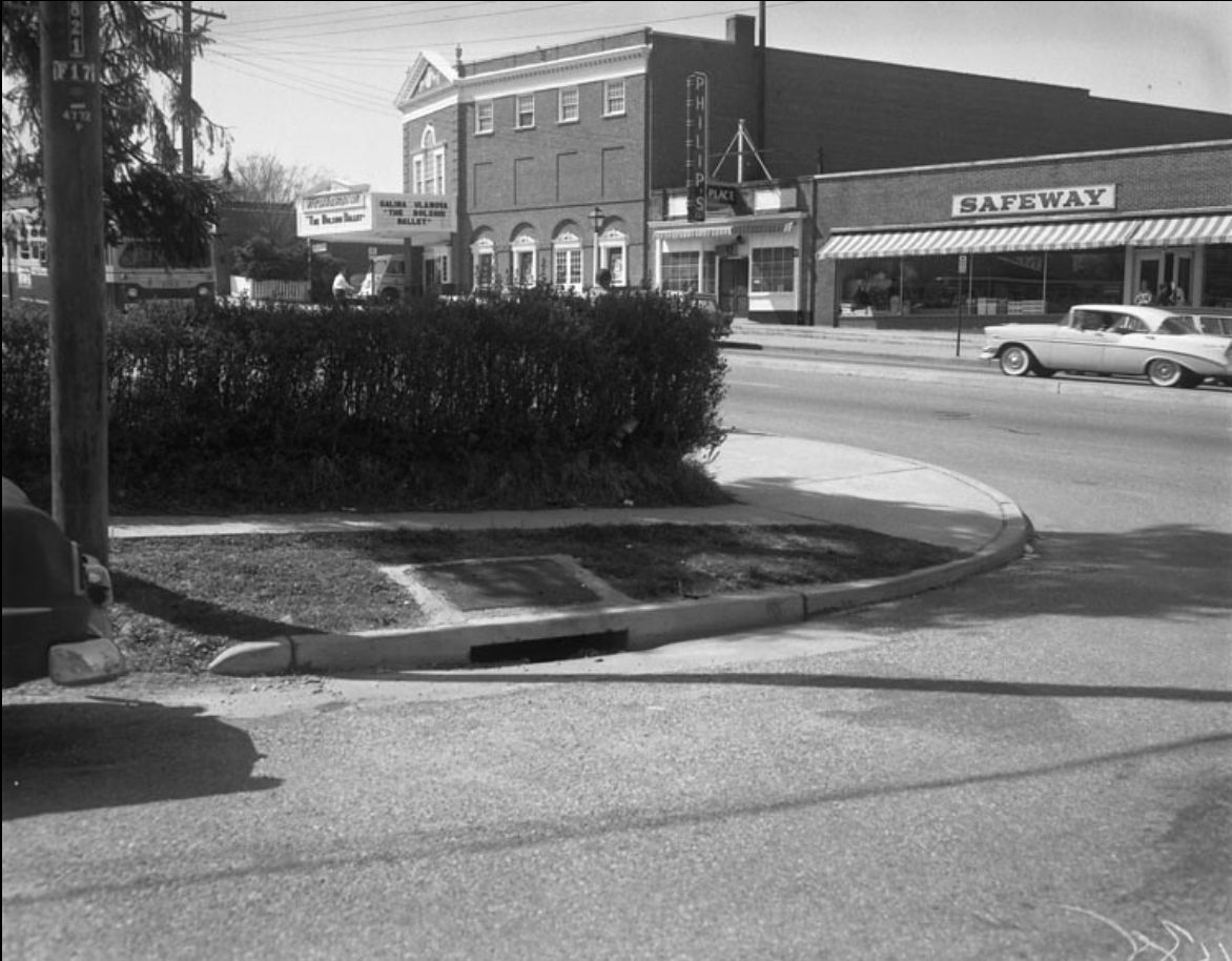
Below is a photo of the Country Club of Virginia, looking to the north. That's Saint Andrews Lane behind the building. I wish this photo was a bit wider to show the original Three Chopt Road entrance. Today it's about halfway between Cary and St. Andrews. But until about 1970 it was right at that busy intersection of Cary, River Road, Three Chopt, and Saint Catherine's Lane.
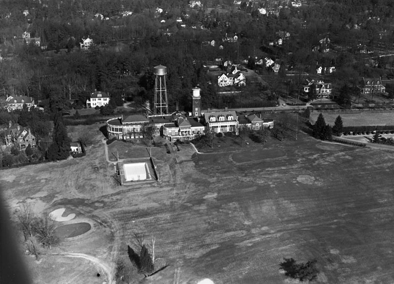
So far I haven't found a photo of the original CCV entrance, but when I do, I'll post it here. It was designed by the noted Richmond landscape architect Charles F. Gillette.
Until then here's what was located on that exact spot at an even earlier time. This photo is looking down River Road from Three Chopt and Cary. The Westhampton Post Office was established here in 1874, but in 1886 the post office was renamed Rio Vista. John Lennox, a prominent local resident, was named postmaster. Mr. Lennox (1847-1910), a native of Scotland, operated the store in the immediate northwest corner of the intersection and also owned the tract of land to the south of River Road that became Hampton Hills in 1923.

John Lennox can be seen in the far left of this 1907 photo above. In 1909 he sold the site of his original Rio Vista store on the north side of River Road to the Country Club of Virginia, and relocated the building and his business to the south side of the road. His operations there were short lived, with his death occurring on 29 October 1910. The building in this photo is still where Mr. Lennox moved it, but it's now known as 14 Rio Vista Lane, directly behind The Tuckahoe.
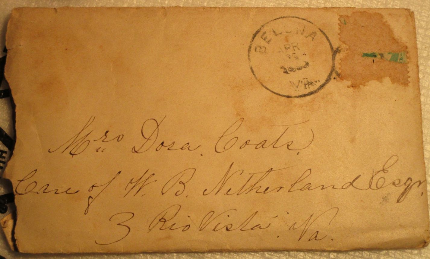
I should also mention that my maternal grandmother grew up in Rio Vista. I have many letters, deeds, ect, some of local historical significance, that I'll eventually document on a separate page. But I'll put a link to it here because of the Westhampton/Rio Vista connection. But for now below is a letter with postmarks. It was mailed from Belona, Va (Powhatan County) to my great-grandmother in Rio Vista.
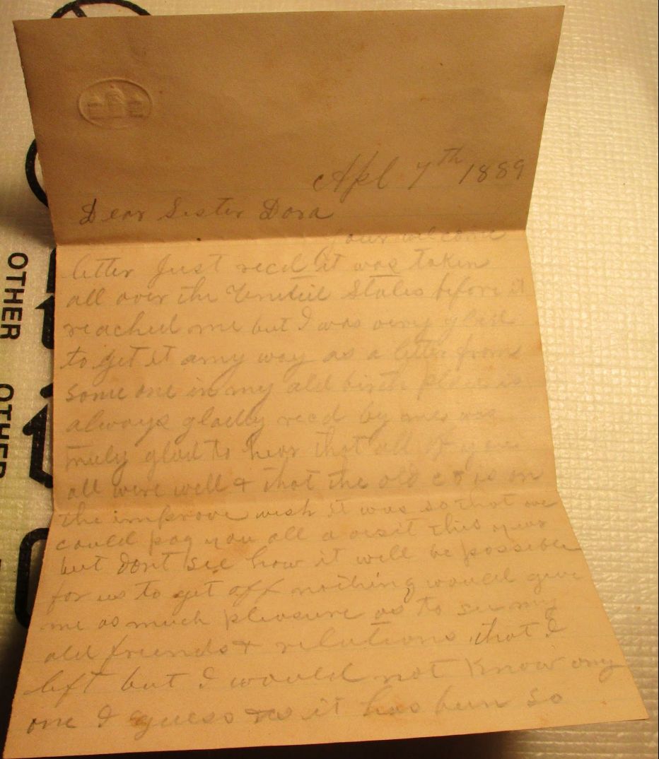
Unfortunately the date in the sending postmark is smeared, but the letter was written on 7 April 1889 as shown on the first page:
Below the back of the envelope is postmarked as received at Rio Vista on Friday April 26th.
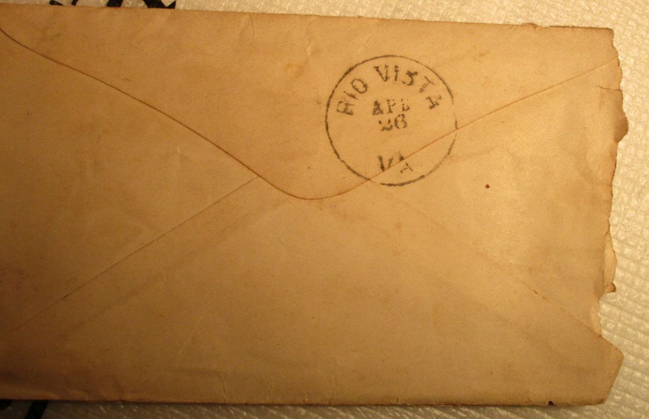
That seems like a long time to go 20 miles, but without knowing the exact sent date, it’s possible the letter wasn’t in transit the whole time. Some of the later letters have Rio Vista postmarks with the hour stamped along with the date received. I think it’s a good bet that John Lennox himself may have stamped this letter and handed it to my great-grandmother.
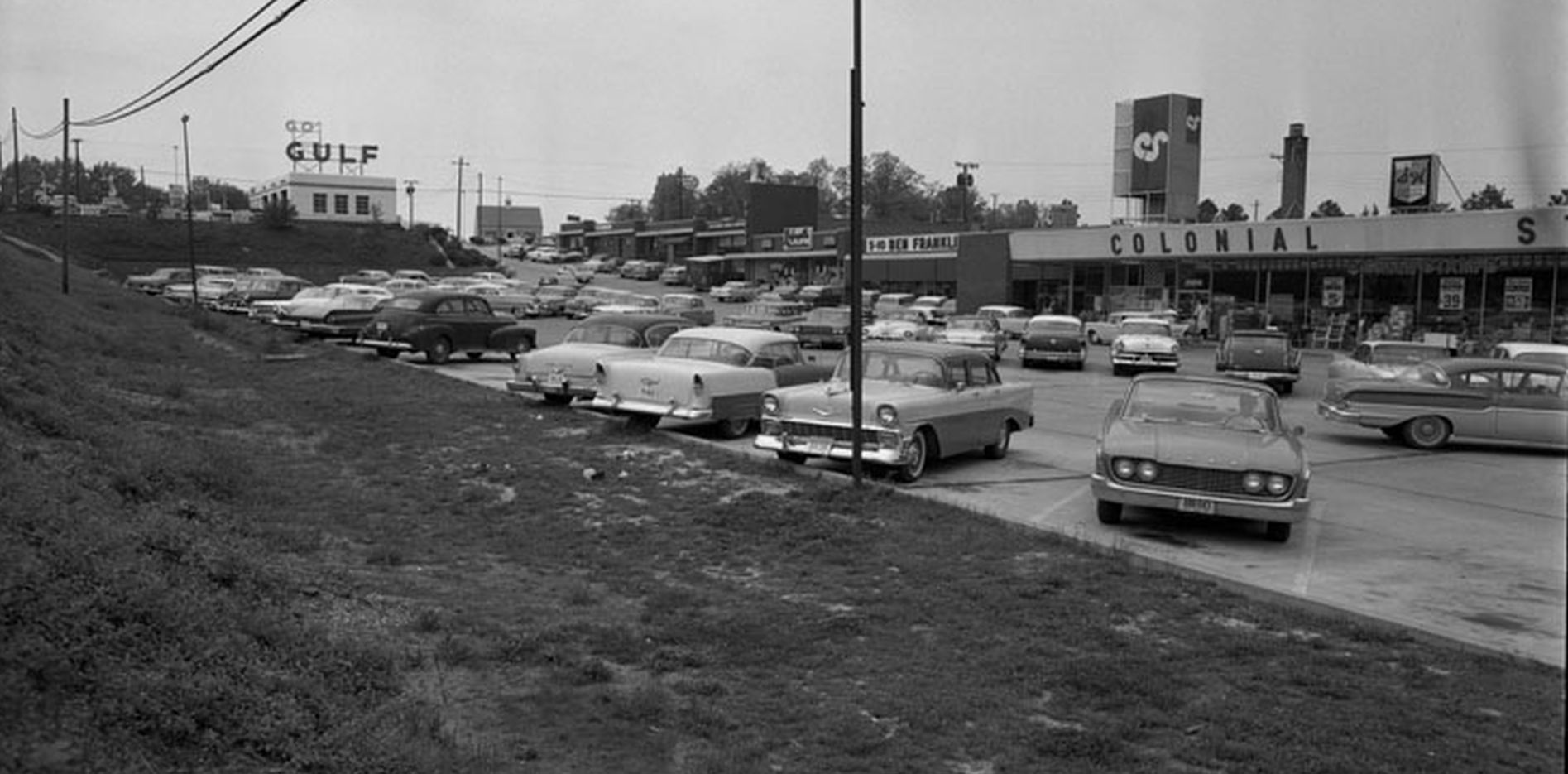
The next photo shows the Beverly Hills Shopping Center. This is a bit out of the Westhampton area, but there's a Westhampton connection. If you were standing on Patterson near the Village Shopping Center, you could easily see that Go Gulf sign. And at night you would definitely notice it. That S&H Green Stamps sign on the Colonial Store brings back memories. While this shopping center is now located at the corner of Patterson and Parham, back then it was Patterson and Ridge. Originally Parham only went from Broad to Three Chopt. Parham took over this existing stretch of Ridge as it grew into today's monstrosity. More Parham Info
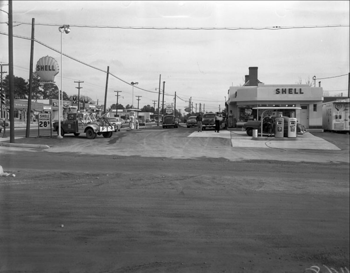
By February 1959 work on Patterson had progressed, but wasn't finished. The photo below looking east from the Blue Scottie Esso, shows life returning to nornal.
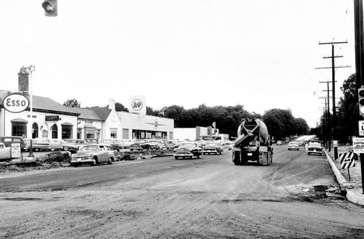
In the photo below taken in May 1959 looking westward, you can see how Patterson narrows to two lanes past Maple. The final section for the city would take another few years to widen the street from Maple to Three Chopt. Over the years, section by section, Henrico widened Patterson all the way through the county. Now even Goochland has a stretch of four lane roadway.
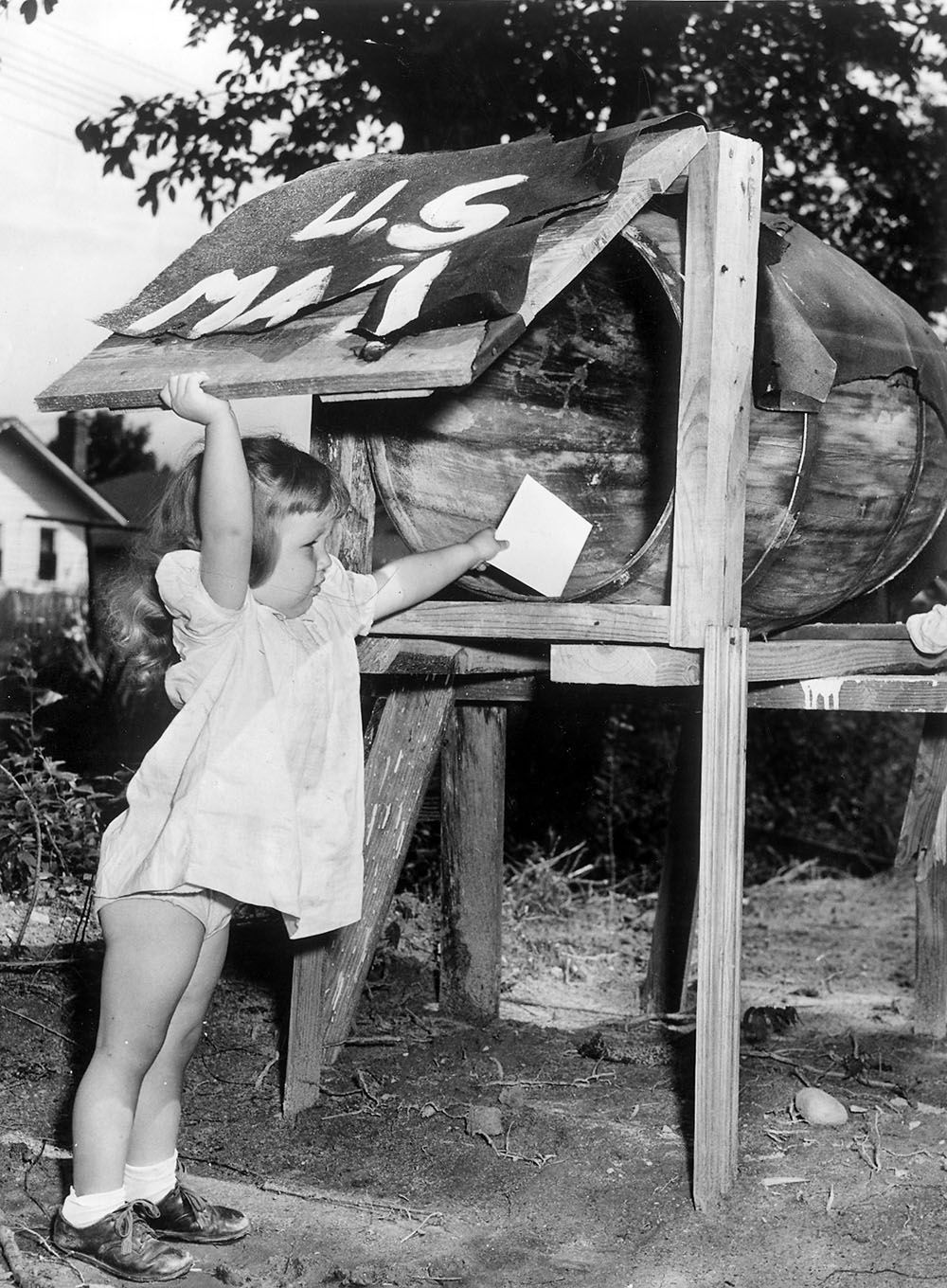
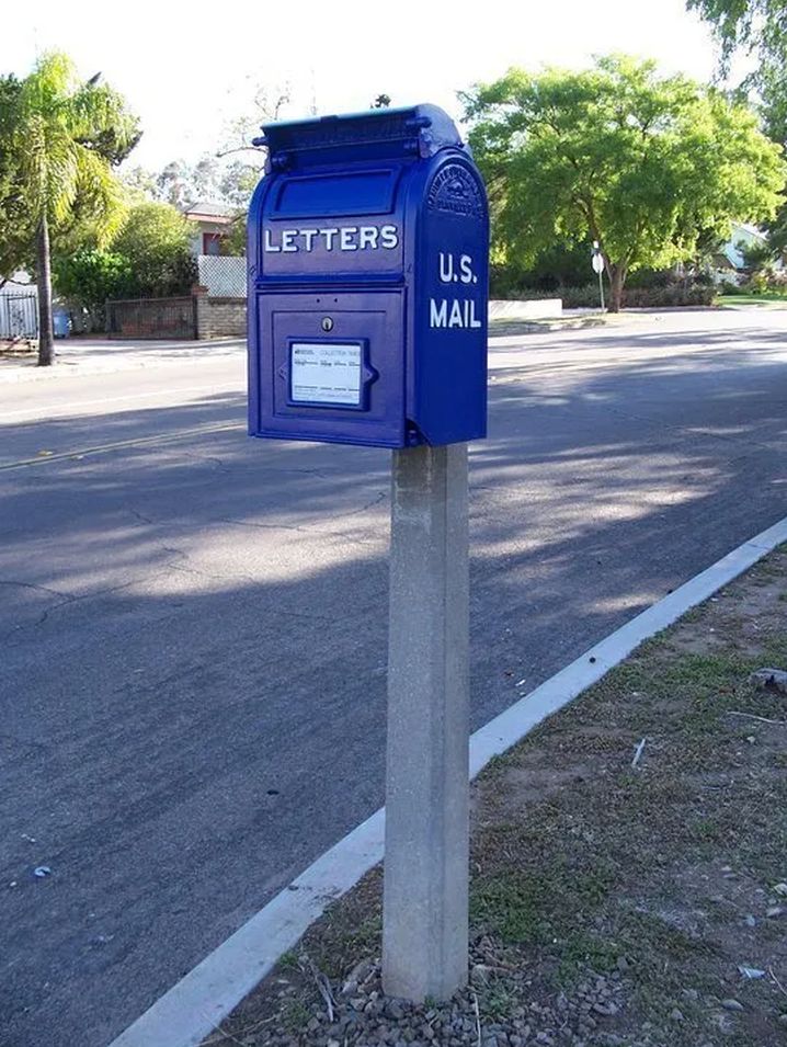
Whenever the Richmond Times-Dispatch has a slow news day, they are fond of running this photo of my neighbor, Sherry Gilman, from September 1950 placing a letter in a barrel-turned-mailbox on Honaker Avenue. I moved into the neighborhood in 1953, and don't remember that landmark or know its exact location, but for about 50 years there was a small cast iron drop-bottom letter box called an “Owen” box on the northeast corner of Stuart and Honaker similar to the photo below.
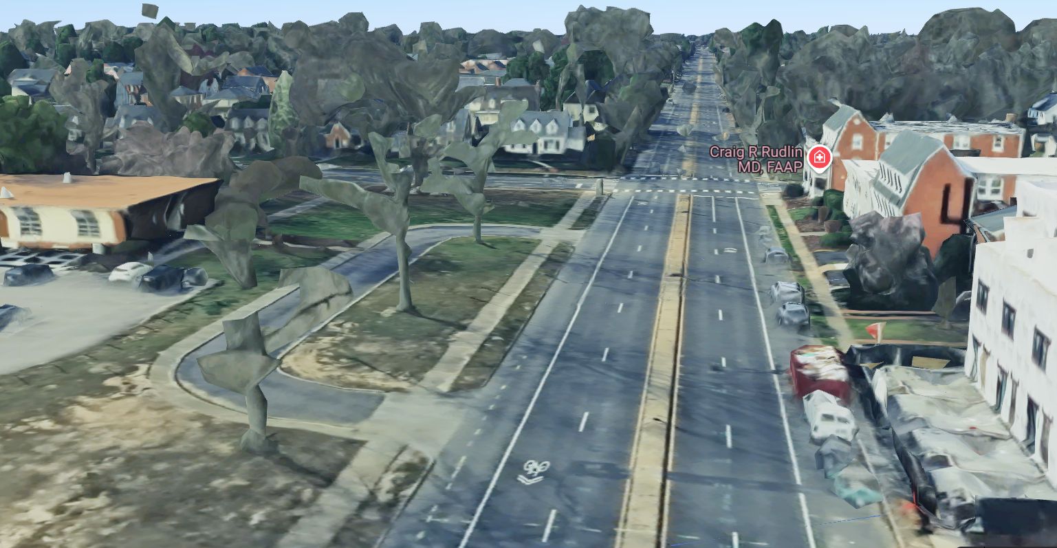
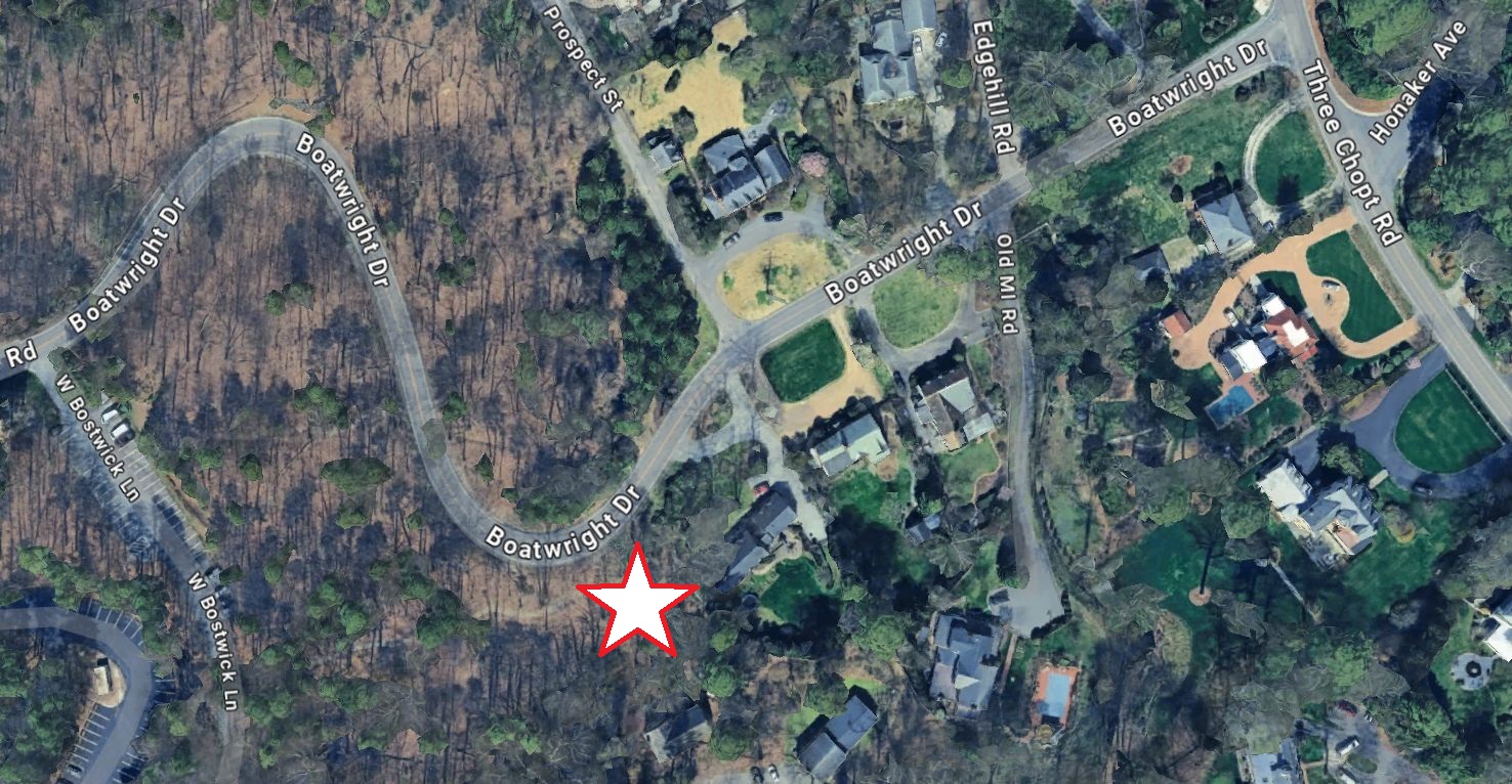
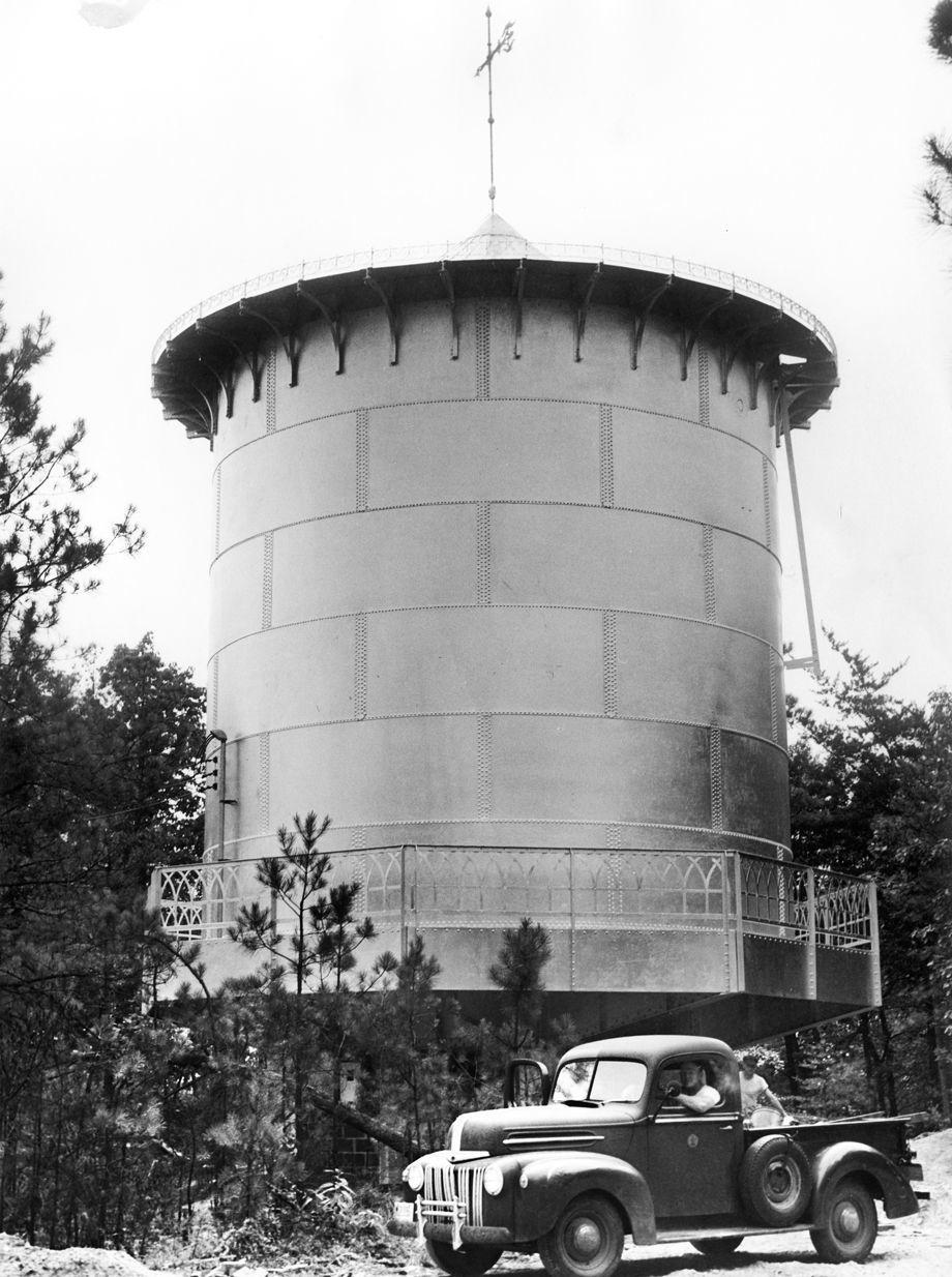
One final Westhampton memory...The old water tower on University of Richmond property, just east of Boatwright Drive. Built in June 1951, this water storage tank was used to help the city sell water to Henrico County. I'm not sure when it was removed, but I think it was still there in the 1970s. In the 1950s and 1960s we would often climb on its lower level walkway. Twice with the aid of a rope ladder, I made it all the way to the top. But I never got inside the tank. Some of the older kids bragged about swimming in it...and doing nasty things in the water, but I was always skeptical about that. Below is a map with the approximate location marked with a star.
The city still sells water to Henrico. One of the main pipelines is under Bandy Field, just a few feet from Bandy Road, and running parallel to it. There are also two air relief valves partially hidden by bushes in Bandy Field where you can sometimes hear the excess air being burped out of the system. But that's not nearly as cool as having a giant water tower to play on.
For more information than any human could ever need to know about the stream that ran through our neighborhood, check out the link below: