
Pictures from Westhampton's Past
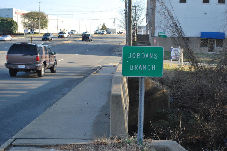
The Westernmost Section of Jordan's Branch...Richmond Virginia
Some people call our section of Jordan’s Branch “Tiber Creek”. Both Tiber Lane and The Tiber Condominiums are located near its path. But in the 1950s all the neighborhood kids knew it as Silver Creek.
Our neighborhood’s Silver Creek was just the westernmost extension of a system of streams that drain the Jordan’s Branch watershed. Our corner of the watershed is a relatively steep valley with Three Chopt Road and Patterson Ave marking its ridgelines. In the map below, all rain falling inside the red line makes its way into Jordan’s Branch, and from there empties into Upham Brook in Bryan Park, on its way to the Chickahominy River.
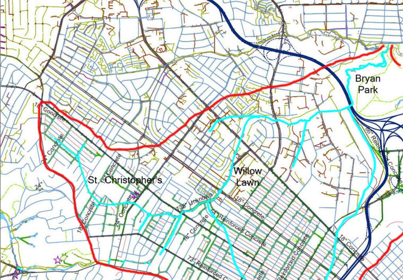
The map above may look like a street map, but a closer look will reveal they're not streets. They're storm sewer pipes. Unfortunately the map doesn’t show the entire Jordan's Branch watershed, but the complete stream route from our neighborhood to Upham Brook is visible. Most of the streams north of Broad are still natural (not underground). South of Broad, most are in concrete pipes underground. One exception to this is the small section behind Tuckahoe Blvd. That is still open to the sky.
As for rain that falls outside the red lines, that goes into neighboring watersheds. On the other side of Cary Street and Three Chopt, that rain goes into the James River. On the other side of Patterson, that rain goes into Horsepen Branch, which empties into Upham Brook near I-64 and Staples Mill on its way to the Chickahominy River. The small section in the lower right of the map above drains into Bacon’s Quarter Branch, the westernmost part of the massive Shockoe system that empties into the James just below the fall line.
Sometimes older maps are helpful because the streams were still natural then. The drawback is they might not be very accurate, and they’re missing many modern streets. But by looking at several we might get the big picture. Below is an 1865 map. I’ve added a few markers to show modern landmarks.
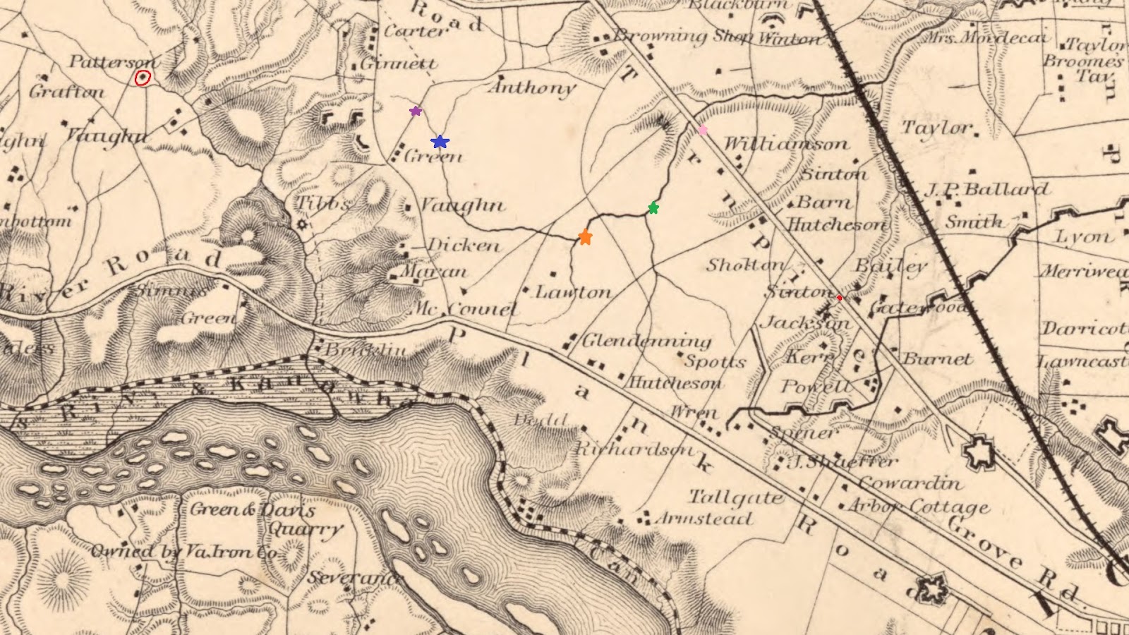
What is now Cary and Broad Streets were then known as Plank Road and Deep Run Turnpike. Patterson Ave. didn’t exist, but Dr. Patterson’s house (Paradise Farm) is marked with a red circle. It’s still there on Lindsay Ct. behind Tuckahoe Elementary School. Of course Patterson Ave. was later named for him, as part of it cut through his land. His farm went as far as Westhampton Lake, like Green's farm. Dr. Patterson also created Lucky Strike cigarettes. Link to Paradise Farm article. But that’s in a neighboring watershed (Little Westham Creek).
Purple star is the intersection of Hanover and Honaker. This map shows Silver Creek going to about Carlisle’s house (6718 Hanover).
Blue star is the intersection of Hanover and Chantecler.
Orange star is the intersection of Patterson and Willow Lawn Drive. In the 1950's when Patterson was a two lane road west of Commonwealth Ave. a little bridge crossed over Jordan's Branch at this spot.
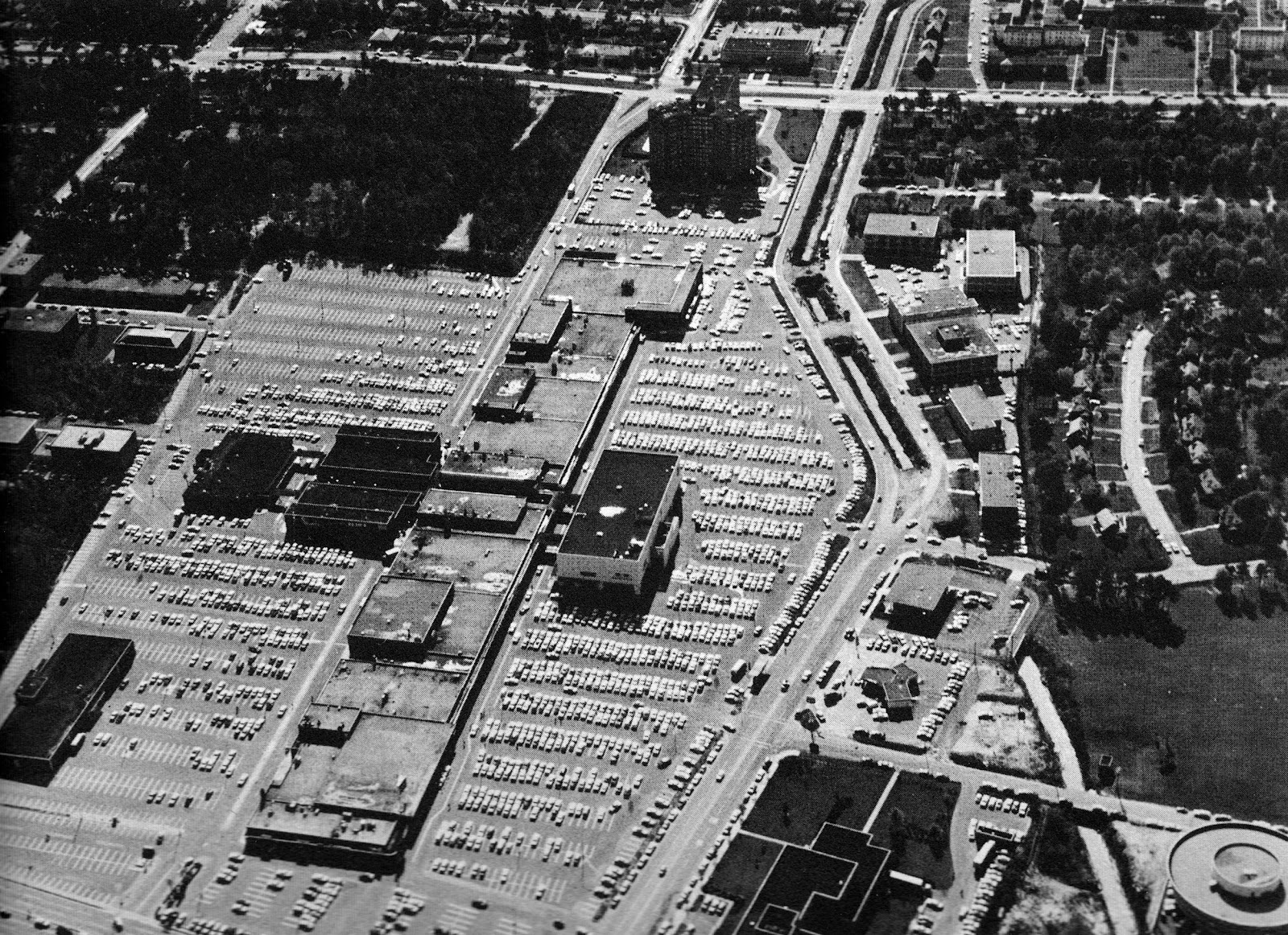
Pink star is the intersection of Broad and Willow Lawn Drive. Below is a 1966 aerial photo looking south from this spot. You can see the natural Jordan’s Branch before it was covered up:
The little red dot is the intersection of Broad and Malvern. On some maps this stream is shown as John’s Branch; others call it Long’s Branch. This map doesn’t label it. It drains all the way from Nansemond and Cary before emptying into the main Jordan’s Branch. Today it then goes under Acca Yards and I-64 before re-emerging in Bryan Park.
Green star is the intersection of Monument and Willow Lawn Drive. This is just north of where the Mary Munford Branch (my nomenclature) empties into our section of the stream. Below is an undated aerial view looking east at the empty lot that would become Mary Munford School. This section of the stream, near its origin, is clearly visible in the photo. Water in that section of the stream drains from as far as Malvern and Cary.

Sidenote: Windsor Farms had fewer houses back then.
The next map requires an explanation. First, pay no attention to the note saying Jordan’s Branch starts at Wesley and Hanover. That’s just plain wrong, but in 2013 when Phil Riggan ran a story in the Richmond Times-Dispatch about what’s hiding under Willow Lawn Drive, he used this map to erroneously mark the start of Jordan’s Branch. Maybe they surveyed during a drought. What’s cool about this map is seeing the streets in 1936. Honaker only went from Patterson to Stuart; Ripley only went from Hanover to Kensington. Hanover was only a nub off of Pepper, and the 6700 block appears to stop around 6725. This may explain why the street had two different widths on the block before the 1966 retaining wall was built, and they finally widened the older western part of the block. Even today the part of Hanover near Pepper is still narrow.

Nowadays Charles Street is a main north-south route in that area, but in this map it looks like Donald Street was planned to go all the way to Broad.
Below is a corrected close up of the 1936 map above, showing the true origins of Silver Creek (Jordan's Branch).

The next map is a bit crude, but I’m including it as a contrast to the previous map. Check out how Silver Creek appears to start right at Three Chopt. It must have been a really wet time!

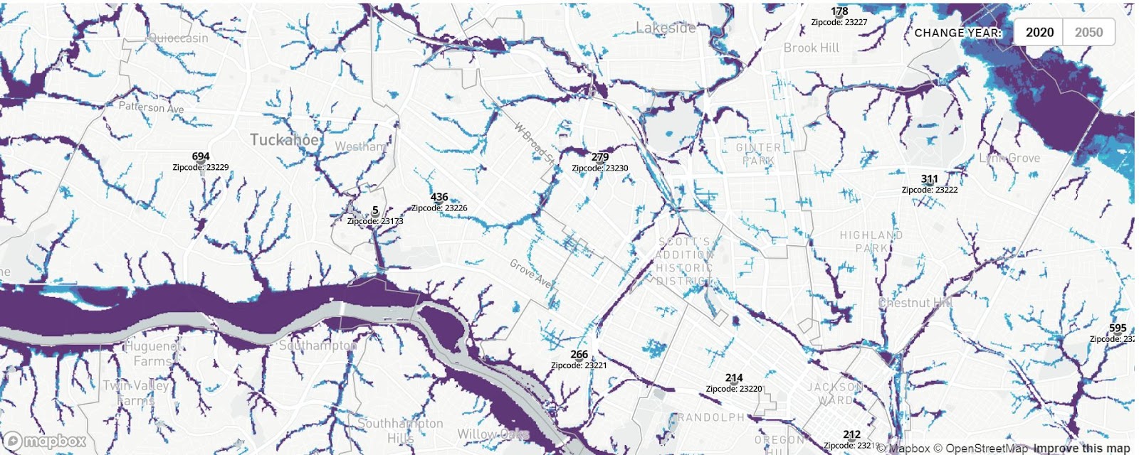
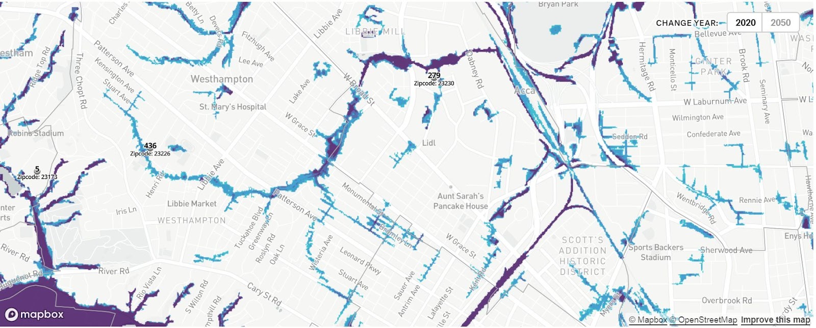
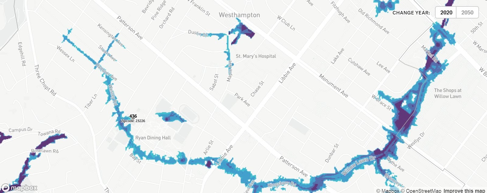
The next map is a little different. It’s an interactive map that lets you scroll to different locations, and zoom in and out. But it shows flood prone areas. This is still helpful because many flood prone areas are around streams. Below are a few screenshots I made of our area.
If anyone has actually made it this far there's one more related item. In 2016 I was interviewed by the Richmond Times-Dispatch about the Westhampton neighborhood. Of course I mentioned our stream. The article is now behind a paywall, but I put a free screenshot of it at this link: